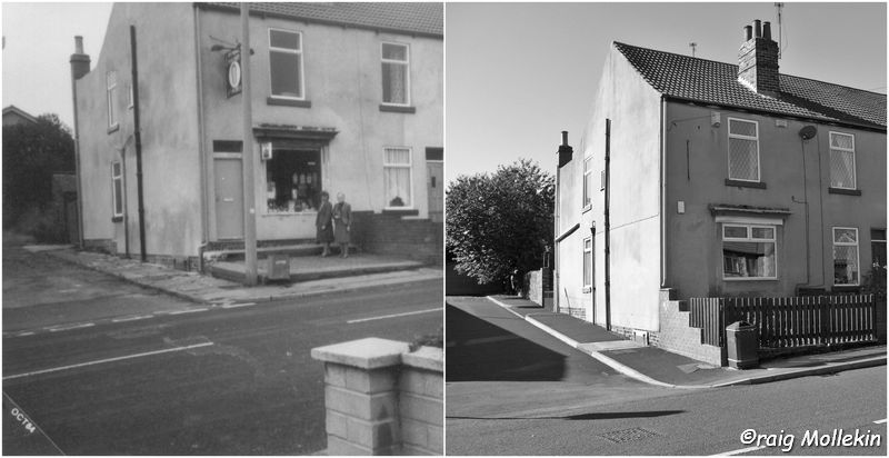
245 Queen Street, Swinton

245 Queen Street, Swinton in 1984 & 2010
This entry pertains to the Bowbroom area of Swinton, focused on a family that had lived here.
CONTACT FROM AMERICA – In February 2009, David Watts from America contacted me via my website and informed me that one of the photos in my Swinton Record project, pertained to his family tree. I then proceeded to do further genealogical research on David’s behalf which uncovered many remarkable finds.

Bowbroom, Swinton in 1855 & 1892
One of the first amazing discoveries in David’s family tree was that he descends from the Barron and Hartley glassmaking families that had moved to Mexborough from Hunslet (near Leeds) in the first half of the 19th century. David is also connected by marriage to the Kilner glass makers of Conisbrough.
THE STEVENSON FAMILY, BOWBROOM & SWINTON – Bowbroom (also known as Baw Broom and Bow Broom) is a very small area in Swinton, South Yorkshire, and probably few people have heard of the location other than the people that live there. On the 1855 map of Swinton, Bowbroom doesn’t appear to be inhabited by humans whereas, by 1892, there is plenty of activity.

William & Catherine Stevenson’s Grave in Saint Margaret’s Churchyard, Swinton
David’s second great grandparents were called William Stevenson and Catherine. William, originally from Ilkeston in Derbyshire, moved to Denaby in South Yorkshire sometime in the 1860s. By the 1881 Census and on the 1891 Census, William is a Grocer and Provisions Dealer at 95 Queen Street, Swinton. By 1901 he is living in the Mexborough end of Swinton on Frederick Street and is recorded as being a retired Publican. William and his descendants had a strong presence in the Bowbroom/Queen Street areas of Swinton and in surrounding neighbourhoods:-
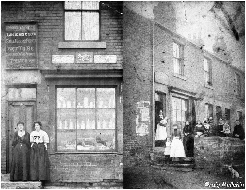
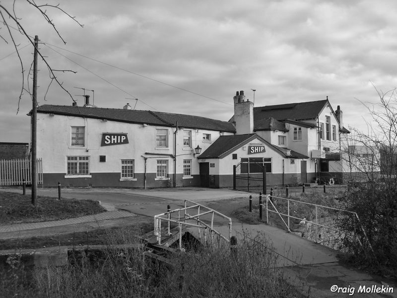
– William’s daughter, Harriet, born circa 1863, married Jonah Jones and together issued at least ten children. Harriet and Jonah are David Watt’s great-grandparents. On the 1891 Census, Jonah is a Licensed Victualler at the Cresswell Arms, 5 Thomas Street (Bowbroom). Presumably, Jonah must have passed on the license of the Cresswell Arms to his brother in law, Fred Walker (see below) who was the Inn Keeper of the Cresswell Arms on the 1901 Census. On the 1901 and 1911 Censuses, Jonah is a Publican/Beerhouse Keeper of the Butchers Arms (Station Street, Swinton).

Lupton’s Shop (Queen Street), 1 Manvers Road & 33 Queen Street, Swinton
– William’s daughter, Lily, born circa 1865, married John William Firth who on the 1901 Census was a Grocer at 90 Dolcliffe Road in Mexborough and then a Grocer at 1 Manvers Road in Mexborough (now converted into a residential dwelling).
– William’s daughter, Hephzibah, born circa 1867, was firstly married to Joe Worby who was a Grocer and Provisions Dealer at 48 Queen Street on the 1891 Census. By the 1901 Census, Joe had died and Hephzibah was married to Fred Walker who was an Inn Keeper at the Cresswell Arms, 5 Thomas Street (Bowbroom). By the 1911 Census, Hephzibah was once again widowed and a Grocer at 33 Queen Street.

Albert Street, Frederick Street & Stephenson Place, Swinton
– William’s daughter, Alice, born circa 1873, married Tom Lupton who was a Grocer at 80 Queen Street on the 1901 Census and then a Shopkeeper at 215 Queen Street on the 1911 Census. On Queen Street near to the Bowbroom area, there is a row of terraced houses known as Lupton Buildings. Nearby to these houses was a shop which I remember well and which closed circa 1998.

Bowbroom Wesleyan Reform Church, Swinton
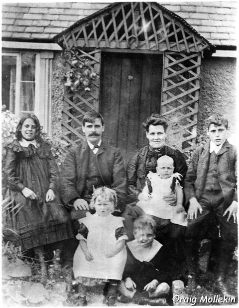
STEPHENSON PLACE – Hephzibah Jones (1881 to 1951) was a daughter of the above Jonah Jones and Harriet Stevenson. Hephzibah married Samuel Young. Hephzibah and Samuel issued at least six children, one of which was called Hephzibah Young. Hephzibah was born in 1912 at 245 Queen Street (Bowbroom). Hephzibah is the mother of David Watts. Included in this entry are photos of Hephzibah Young (nee Jones) standing outside of 245 Queen Street (Bowbroom).
David’s mother visited her birthplace in 1984. The broken up paving and cobbles of Stephenson Place are visible in the 1984 photo and were visible for many years after – well into the 1990s and possibly even into the 2000s.

Cresswell Arms, Bowbroom W.M.C. & Thomas Street Stores
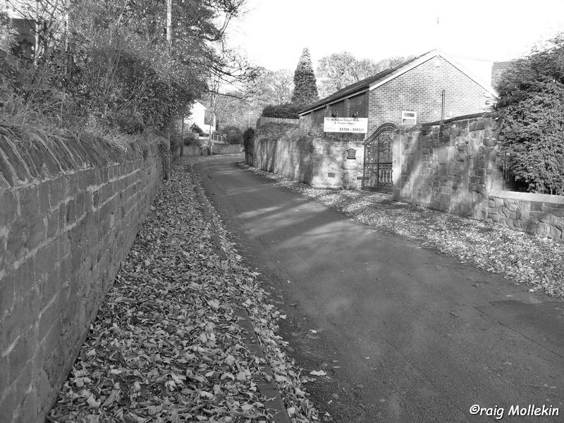
245 Queen Street (where David’s mother was born) was a Grocery shop. I visited this shop many times and it was known locally as Sams’ (the name of the owner (Samuel Whitworth) in the 1970s and 1980s) or the ‘Beer Off’ as it was an Off Licence. I was, in fact, the last customer of this shop circa May 1997. I’d always previously believed that the road (now a dead end) to the left of the shop was formerly Albert Street before Albert Street was rebuilt in the 1970s and further extended in the 1980s. However, after studying maps of the area, I realised that the location of Albert Street has never changed (except for the 1980’s extension). The road next to the shop is in fact known as, Stephenson Place. Although Stephenson Place is visible on maps from the late 19th century onwards, it was not until 1930 that it is given an actual name on a map. I believe that Stephenson Place may have been named as such due to David’s Stevenson ancestors living in the vicinity (I appreciate the difference in spelling although on the 1901 Census it is called Stevenson Street).

Bower Road & Hatherley Road, Swinton
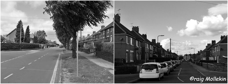
CHANGES IN BOWBROOM – Noticeable changes in the Bowbroom area since when the Stevenson families lived in the area are:-
– Demolition of the old housing. I remember as a child there being waste ground where what is now the new extension to Albert Street/back of Stephenson Place. There were piles of old bricks and I recall Bonfires taking place on this land.

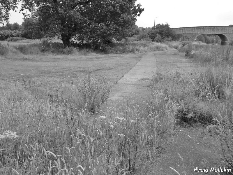
Dearne & Dove Canal, Bowbroom, Swinton in 1995
– Bower Road and Hatherley Road were created in the late 1930s by Swinton Urban District Council. They were named after prominent Swinton residents, Aquila Bower and Doctor Sydney O. Hatherley.
– The Cresswell Arms pub was rebuilt in the 1940s. Running alongside the modern day Cresswell Arms appears to be the remains of an old access road. I believe that the now redundant road running in front of the Cresswell Arms was perhaps a section of the original Thomas Street.
– The Cresswell estate was erected in the early 1960s, which included new streets in Bowbroom, called Cresswell Road, St Michaels Avenue and Queens Avenue, along with adding houses to Bower Road, Queen Street, and Thomas Street. Thomas Street was extensively redeveloped.

Cresswell Road & St. Michael’s Road, Swinton
– Bowbroom W.M.C. Club, on Thomas Street, was also rebuilt and a row of shops opposite, with flats above, were built.
– The Dearne and Dove canal at Bowbroom was mostly filled in, in the 1960s although small stretches of it still remain today.
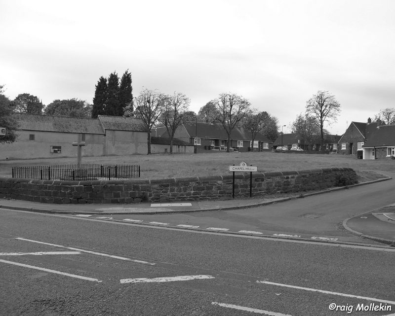
– The Chapel was rebuilt in the 1970s in a slightly different location. Originally, it appeared to be set behind housing on Queen Street and accessible from Stephenson Place. It is now located on the corner of Queen Street and Stephenson Place, adjacent to the Grocery shop (245 Queen Street).

Bowbroom, Swinton in the 21st Century
– The 19th-century bridge spanning the Dearne and Dove canal was blown up and rebuilt in the 1970s. The course of Queen Street was slightly altered/straightened when they did this.
Although the majority of the original buildings in the Bowbroom area have been demolished and rebuilt, I’m sure that Bowbroom’s past inhabitants would still recognise the area.
FINALLY – Special thanks are owed to David Watts for the supply of the old photos featured in this entry. Any comments, photos or memories of Bowbroom which people may have, would be appreciated.